Know every
block.
To the metre.
Most growers are working off old plans and guessed block sizes — and that guess quietly skews every chemical rate, spray volume and yield estimate that follows. We map your property from the air to centimetre accuracy.
A wrong block size
is a wrong rate.
Get the hectares wrong and everything downstream inherits the error — you over- or under-apply chemical, mis-budget inputs, and can't trust your per-hectare numbers. An accurate map fixes it at the source.
Four ways to see
your property clearly.
One flight captures it all — we turn the imagery into accurate, usable maps you'll reach for all season, and well beyond it.
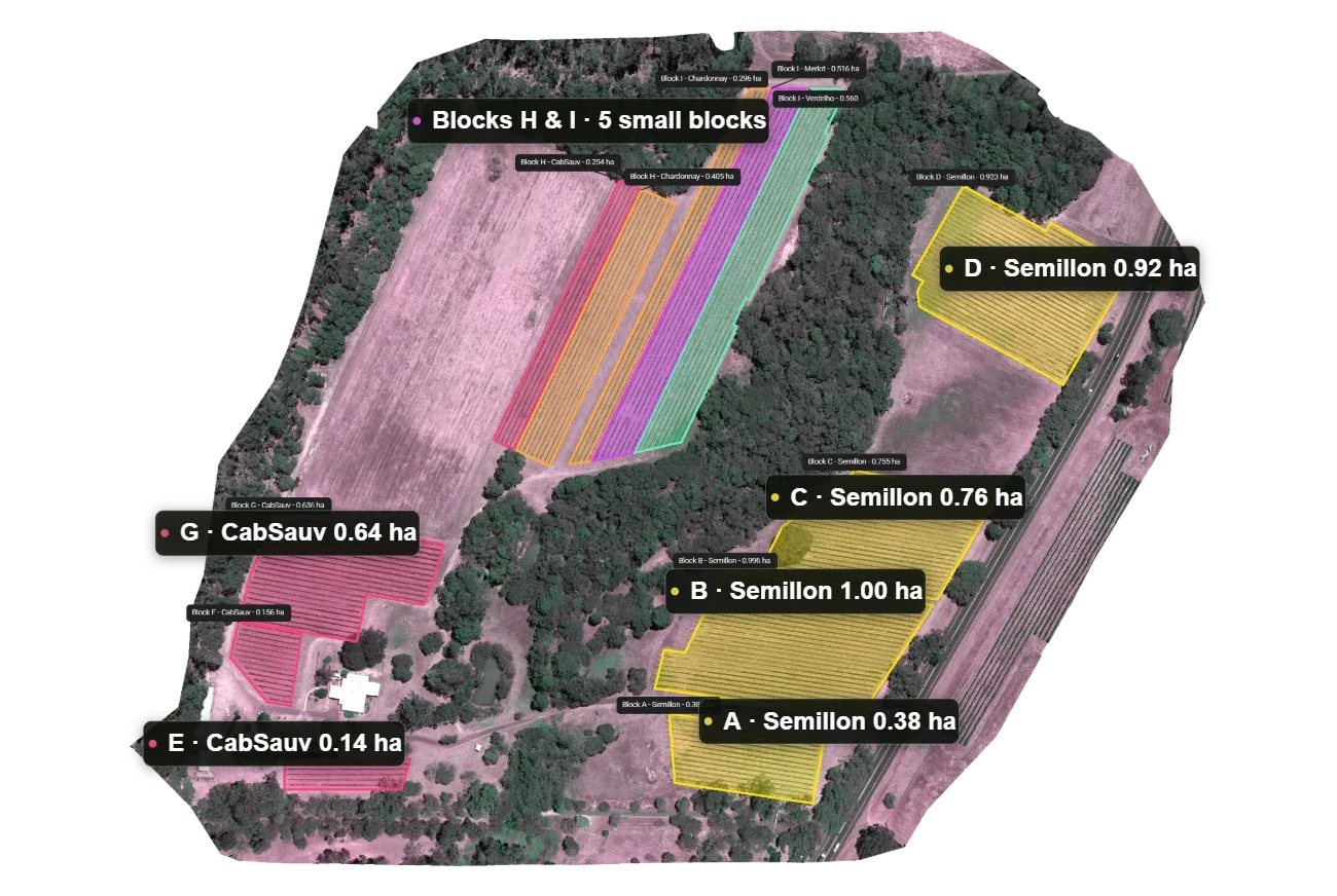
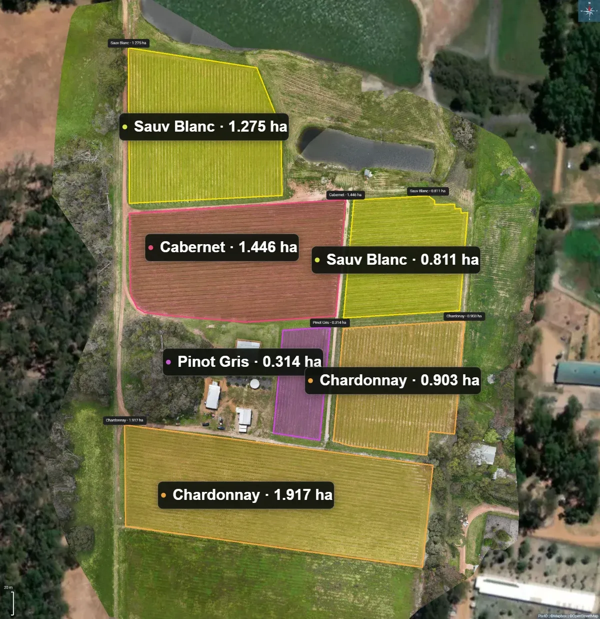
Accurate block mapping
Centimetre-accurate boundaries for every block — the true area planted, colour-coded by varietal, delivered as a live Google Map you can click through and as print-ready files.
- Real area under vine — per block and total
- Varietal colour-coding across the property
- Interactive Google Map render + print files
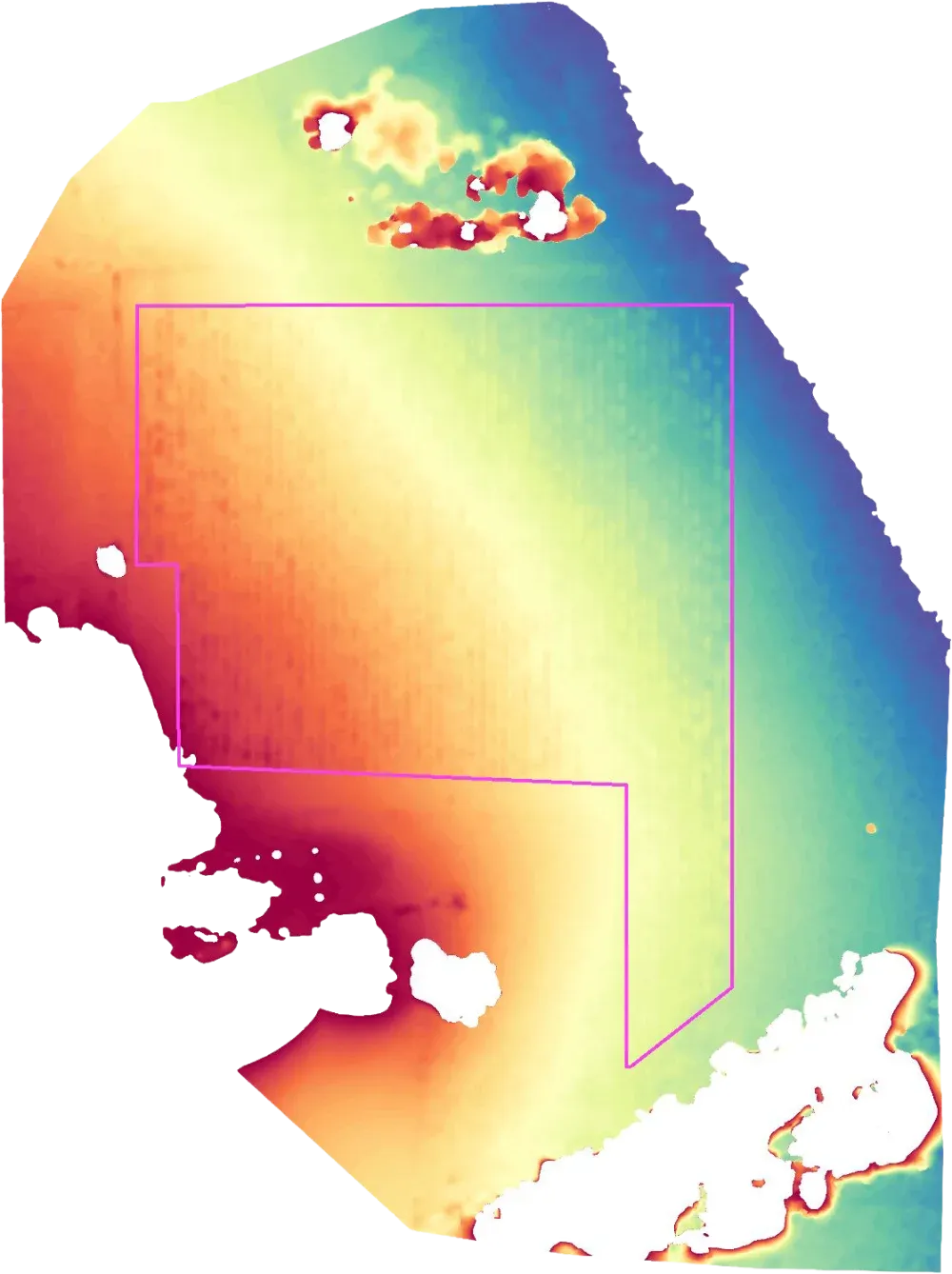
Slope & elevation
An elevation model of the property showing block aspect, slope and the lie of the land — the detail behind frost pockets, drainage, and where each varietal will do best.
- Block aspect & slope, mapped
- Spot frost risk & drainage lines
- Plan plantings & infrastructure with the contour
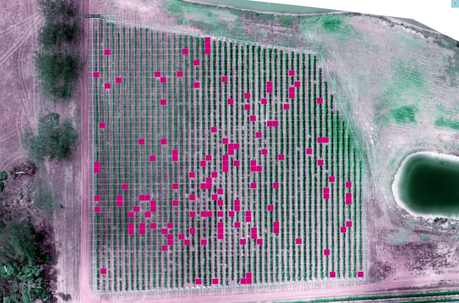
Missing vine analysis
We detect missing and dead vines across the block and report what you're carrying against a full planting — so replant decisions and yield-potential numbers are based on what's actually in the ground.
- Every gap located across the block
- Percentage of potential planting, per block
- Target replanting where it counts
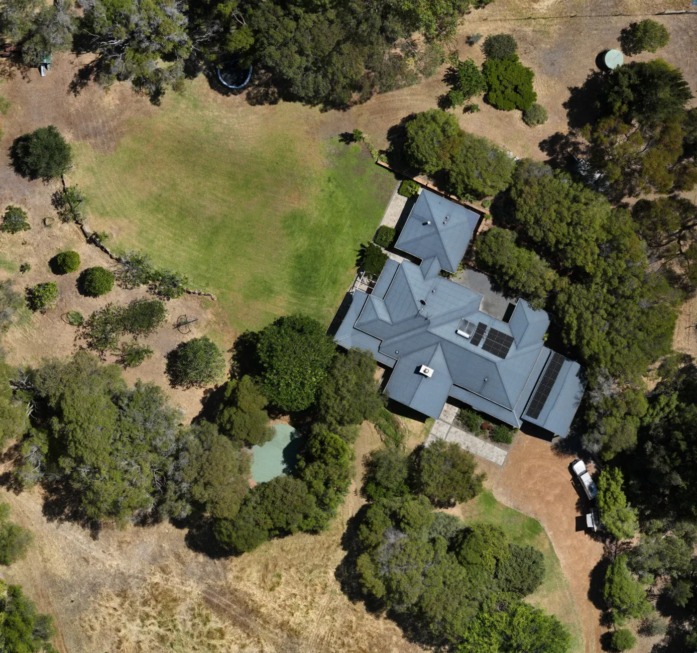
High-resolution imagery
Crisp aerial photography of the property — striking enough for the cellar-door wall or the office, and ready to drop straight into your website, brochures and marketing.
- Print-quality stills for wall & cellar door
- Web & brochure-ready imagery
- A genuine asset for your brand
One accurate map.
Used all season.
A good survey isn't a one-off novelty — it's a reference you'll come back to for the decisions that cost real money.
Correct chemical rates
The big one — every per-hectare rate finally rests on a real area, not a guess.
Spray & fertiliser volumes
Mix and order the right amount for the real area — less waste, fewer surprises.
Water & infrastructure
Plan irrigation, rows and access against an accurate base map and the contour.
Replant & yield decisions
Vines-per-block and gap data make replanting and yield-potential numbers you can trust.
Valuation & sale
Accurate area and planted detail back up a property’s value at sale or lease.
Marketing & cellar door
Beautiful aerials and clean block maps for your website, labels and tasting room.
Map your
property.
Tell us about your blocks — we'll fly the property, measure it properly, and hand you maps you'll actually use. Stop guessing your hectares.