See the
variation.
Then go stand in it.
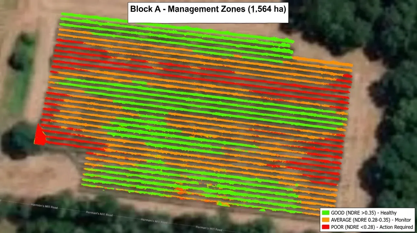
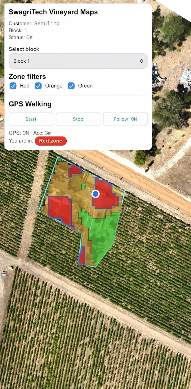
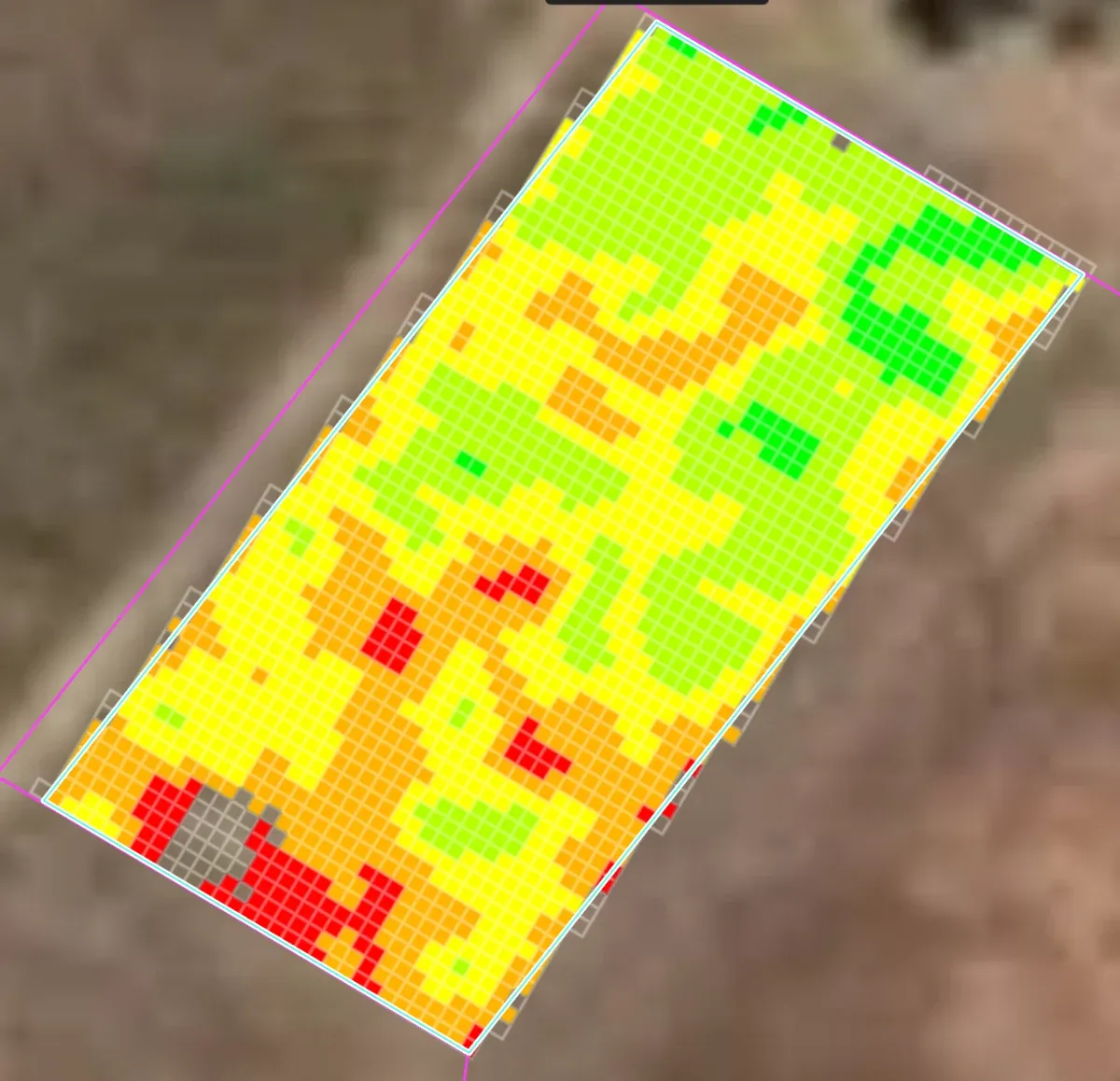
We map your blocks from above in NDVI & NDRE — then hand you the map as an app you walk with. GPS shows which management zone you're standing in, vine by vine.
More than the
eye can see.
Our drones carry multispectral sensors that read NDVI and NDRE — indices that quantify canopy health and stress weeks before it's visible from the seat of a ute.
The map, in your pocket.
A static PDF dies on your desktop. Ours is a field app — open the private link we send you, install it on your phone, and walk the block with the map live under your feet.
Live GPS walking
Hit Start and your position shows on the map — follow-mode keeps you centred as you walk the rows.
Real-time zone lookup
The app tells you which zone you're standing in the moment you step into it — Good, Average or Poor.
Installs on any phone
iPhone or Android, no app store — add it to your home screen and it's ready in the field, even with patchy signal.
Block by block
Switch between your blocks, toggle zones on and off, and pick up right where you left off next visit.
From the air
to the vine.
A map shows you where things differ. Walking it tells you why — and that's the difference between a pretty picture and a decision.
We fly & map
Multispectral capture over your blocks, processed into NDVI/NDRE health zones tied to your boundaries.
You install the app
We send a private link or QR for your vineyard. Open it once and it’s saved to your phone.
Walk the block
GPS guides you to each zone and tells you, live, which one you’re standing in.
Ground-truth & decide
Look at the actual vines, confirm what’s driving the zone, and turn the map into a plan.
Most operators
stop at the
PDF.
- A static map emailed over as a PDF
- No way to find the spot in the field
- You're left to guess what it means
- An app that lives on your phone
- GPS walks you to the exact zone
- Ground-truth it, then act with confidence
Let's map
your season.
Tell us about your blocks — we'll fly them, build your zones, and set you up with the app so you can walk the variation yourself.